WELCOME to the
Lake Buchanan / Inks Lake Chamber of Commerce & Visitor Center
|
Please Don't Miss Your Most Important Stop in your Texas Hill Country Adventure!
Established in 1958, the Lake Buchanan / Inks Lake Chamber of Commerce & Visitor Center is located just west of the Inks Lake / Colorado River Bridge between Burnet and Llano counties. When you visit the Lake Buchanan / Inks Lake Chamber of Commerce & Visitor Center, you'll discover a wealth of information and resources to enhance your stay in this beautiful Texas Hill Country region. The friendly and knowledgeable staff will greet you warmly, ready to provide insider tips on the area's best attractions, outdoor activities, and hidden gems. You can expect to find detailed maps, brochures, and guides showcasing the stunning natural beauty of the Lake Buchanan and Inks Lake area, along with information on local events, dining options, and accommodations. The center offers multiple displays that highlight the region's rich history and diverse ecosystem, making it an excellent first stop for both nature enthusiasts and history buffs. Whether you're planning a day of water sports, a scenic hike, or a relaxing weekend getaway, our Visitor Center is your gateway to experiencing the best of what this picturesque lakeside destination has to offer. You'll be greeted with a smile and an enthusiastic HOWDY! TEXAS FRIENDLY SPOKEN HERE! |
|
▬ Lake Buchanan and Inks Lake ▬
. . . two jewels in the chain of lakes known as the "Highland Lakes", tucked between the "Bluebonnet Capital" (Burnet) and the "Deer Capital" (Llano) of Texas. Lake Buchanan is big, wide, open, and uncrowded. Sadly, Buchanan Dam has been closed to the public since 2007 per Homeland Security regulations, HOWEVER, we have a wonderful view from our OBSERVATION DECK behind the Visitor Center. Boat launching can be a challenge depending upon the current lake level of Lake Buchanan. GOOD NEWS! The lake is WAY UP and ALL launch sites are open! Burnet County Park ramp is always available to launch from. The Llano County Park ramp is currently OPEN as the lake has risen from recent rain. Please contact local lodges and resorts for their current ramp conditions. Inks Lake is smaller, sheltered in a canyon and extremely cozy. Inks Lake launch is at Inks Lake State Park. Another boat ramp option is the Kingsland Community Park boat ramp on Lake LBJ. Current Lake Buchanan level (updated daily) |
|
The Highland Lakes Explained:
The Highland Lakes are a series of freshwater lakes along the lower Colorado River in the Hill Country region of Texas. The lakes are formed by dams built and operated by the Lower Colorado River Authority (LCRA) to generate power and help with flood management. They also draw visitors to the area year-round for water recreation and fishing.
Let us introduce you to the Highland Lakes.
The six lakes that make up the chain from top to bottom are Lake Buchanan, Inks Lake, Lake Lyndon B. Johnson (aka Lake LBJ), Lake Marble Falls, Lake Travis, and Lake Austin. Each lake has its unique attributes. Burnet County is fortunate to have all but one of the lakes within its border.
Lake Buchanan, the oldest and largest of the Highland Lakes, was formed after the construction of Buchanan Dam in 1938. One of two reservoirs on the chain, it spans 22,452 acres. It is known for excellent year-round fishing. Bird watchers flock to the area seasonally to spy on bald eagles and hundreds of other feathered friends.
Inks Lake was formed in 1938 with the construction of Inks Dam. It spans 798 acres. Inks Lake State Park and Inks Dam National Fish Hatchery hug the entire east side of the lake and offer a multitude of recreational opportunities.
Lake LBJ was formed in 1951 after the completion of Wirtz Dam. Lake LBJ spans 6,432 acres and offers fairly stable water levels, making it the most popular of the lakes for boating, wakeboarding, and skiing.
Lake Marble Falls, the smallest of the Highland Lakes, emerged in 1951 following the construction of Starke Dam. The “Great Falls” of Marble Falls are on the bottom of the 613-acre lake. Like Lake LBJ, Lake Marble Falls has a near-steady water level, making it a great spot for boating, personal watercraft, and paddling as well as fishing.
Lake Travis, the longest of the Highland Lakes at 65 miles, was formed in 1942 with the completion of Mansfield Dam and covers 19,044 acres. It, too, is a reservoir and has ever-changing water levels depending on drought conditions. It is popular for fishing as well as boating and water sports.
Lake Austin was formed in 1940 upon completion of Tom Miller Dam and covers 1,830 acres. It is located entirely in Travis County. www.highlandlakesofburnetcounty.com/the-highland-lakes-explained/
Welcome to Texas!
From the remote mountains of Big Bend to the dense forests of the Piney Woods; from the warm waters of the Gulf Coast to the refreshing rivers and lakes of the Hill Country, Texas boasts an enticing array of landscapes to explore. As any longtime Texan will tell you, there is no better way to experience the vastness and diversity of the state than from behind the wheel of your own car. Encompassing 254 counties and 268,597 square miles, the country’s second-largest state offers endless routes and itineraries. Whether you want to explore the region’s rich history, experience its diverse cultural offerings, or dine at nationally acclaimed restaurants, the Lone Star State rewards every kind of traveler's desire!
In addition to listings for more than 2,400 attractions in nearly 500 cities, the 2024 Travel Guide includes themed and regional road-trip itineraries, so the opportunities for adventure abound: Explore canyons in the Panhandle, embrace small-town life, seek year-round opportunities for wildflower viewing, learn about Texas’ early colonies, or enjoy the solitude at one of our more remote state parks. Gas up your car, prep your favorite tunes, and get ready to be inspired by the open road.
Everything you could ever want to find out about is in this book, and with its accompanying map, it's your BEST RESOURCE for the Great State of TEXAS -- and you can get your FREE COPY of each at the Lake Buchanan / Inks Lake Visitor Center!
Chamber Members, Friends and Visitors: The Visitor Center and Chamber office is open six days a week, Monday through Saturday from 9:30am to 4:30pm. We're located at 19611 E Hwy 29 in Buchanan Dam, TX 78609, just West of the Inks Lake Bridge, (look for the "Free Maps" sign). Please phone 512-793-2803 for more information.
|
Inks Lake
|
Lake Buchanan |
Fall Creek Falls |
Wild Flowers |
|
Fishing is great all year long!.
If you fish for Hybrid "Sunshine" Striped Bass, Black Bass, White Bass, Crappie, Catfish (Blue, Channel and Flathead,) or Sunfish Lake Buchanan and Inks Lake are where you want to visit. Click here for more fishing info. |
Local Catches |

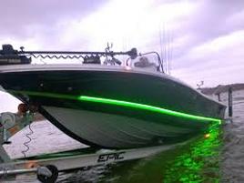
Enjoy a day on the water.
Bring your own boat or rent a watercraft of your choice and have some fun!
Boat launch info.
Bring your own boat or rent a watercraft of your choice and have some fun!
Boat launch info.
|
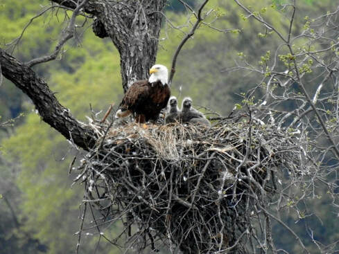
Eagles, Osprey, Herons, Pelicans, Painted Buntings and many more birds can be found for everyone who enjoys bird watching. Our Mating pair of Bald Eagles will return in October, and be with us until early April. |
Enjoy four seasons of great escapes.
If you have any questions while planning your visit here, please CONTACT US and our staff will be happy to assist you. Our Visitor Center is located at 19611 E Hwy 29 Buchanan Dam, TX 78609 just West of the Inks Lake bridge.
Free maps!
Lake Buchanan/Inks Lake Chamber of Commerce
If you have any questions while planning your visit here, please CONTACT US and our staff will be happy to assist you. Our Visitor Center is located at 19611 E Hwy 29 Buchanan Dam, TX 78609 just West of the Inks Lake bridge.
Free maps!
Lake Buchanan/Inks Lake Chamber of Commerce


